| Rank | Name | Altitude | Dimensions | Class | Coordinates |
|---|---|---|---|---|---|
| 1 | Ojos del Salado | 6390 m | 70x70 m | Pool | 27° 7'9"S 68° 32'8"W |
| 2 | Pular | 6190 m | 100x70 m | Pool | 24° 12'3"S 68° 3'55"W |
| 3 | Cazadero | 5990 m | 210x90 m | Lake | 27° 13'50"S 68° 33'53"W |
| 4 | Tres Cruces Norte | 5906 m | 220x150 m | Lake | 27° 2'44"S 68° 48'52"W |
| 5 | Licancabur | 5900 m | 60x30 m | Pool | 22° 50'3"S 67° 53'1"W |
| 6 | Aguas Calientes | 5870 m | 80x50 m | Pool | 23° 21'48"S 67° 40'58"W |
| 6 | Bonete | 5870 m | 150x100 m | Lake | 27° 58'51"S 68° 44'48"W |
| 8 | El Muertito | 5850 m | 80x50 m | Pool | 27° 3'49"S 68° 25'54"W |
| 9 | Mulas Muertas | 5770 m | 190x90 m | Lake | 26° 56'43"S 68° 30'48"W |
| 10 | Ridonglabo | 5760 m | 280x160 m | Lake | 28° 4'21"N 87° 1'52"E |
| 11 | Lago de los Polacos | 5715 m | 150x50 m | Lake | 27° 5'14"S 68° 31'1"W |
| 12 | Karda Lake | 5620 m | 1300x600 m | Lake | 28° 4'6"N 87° 2'50"E |
| 13 | Kangshung Twin Lakes | 5520-5580 m | 570x260 m | Lake | 28° 0'26"N 87° 1'41"E |
| 14 | Thukpe Dzingbu | 5565 m | 110x70 m | Pool | 31° 05'34"N 81° 22'15"E |
| 15 | Baruntse Lake | 5555 m | 230x120 m | Lake | 27° 50'11"N 86° 57'30"E |
| - | Lakes of Kanchengyao | 5100-5400 m | 2000x800 m | Lake | 28° 0'21"N 88° 42'47"E |
| - | Orba Co | 5200 m | 14.8x6.6 km | Lake | 34° 32'15"N 81° 2'25"E |
| - | Laguna Glaciar | 5080 m | 750x350 m | Lake | 15° 49'50"S 68° 33'41"W |
| - | Tilicho Tal | 4920 m | 4.0x1.4 km | Lake | 28° 41'29"N 83° 51'11"E |
| - | Sabalan Lake | 4785 m | 140x70 m | Lake | 38° 16'04"N 47° 50'13"E |
| - | Harris Tarn | 4755 m | 70x60 m | Pool | 0° 9'5"N 37° 19'10"E |
| - | Simba Tarn | 4595 m | 50x50 m | Pool | 0° 8'55"N 37° 19'20"E |
| - | Lago de la Luna | 4215 m | 180x180 m | Lake | 19° 6'26"N 99° 45'9"W |
| - | Lago del Sol | 4205 m | 700x470 m | Lake | 19° 6'36"N 99° 45'35"W |
| - | Pacific Tarn | 4090 m | 230x170 m | Lake | 39° 25'11"N 106° 7'13"W |
| - | Punta dei Corvi | 3280 m | 110x60 m | Pool | 46° 46'25"N 10° 49'4"E |
| - | Lake of Lovers | 3280 m | 170x120 m | Lake | 43° 17'3"N 42° 26'50"E |
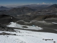
Ojos del Salado is the highest volcano in the world and second highest peak outside of Asia (behind Aconcagua). It lies on the border between Chile and Argentina, reaching 6893 m of altitude. The pool is sometimes erroneously called a "crater" lake, but the half-open crater of Ojos is filled only with snow and firn. In reality the pool it is situated on the slopes of the mountain - 1.2km southeast of Ojos del Salado peak. It is not well visible on Google Earth, but fortunately we have several good photos made by climbers (Harriet & Neil Pike and Zigeiner):

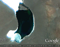
Pular is a volcano in the Antofagasta region of Chile reaching 6233 m of altitude. About 50 meters below the peak there's a frozen pool wih the dimensions of about 100x70 meters. The first image below links to a youtube video with a 360 degree panorama. The lake can bee seen starting at 0:32 timestamp. The second image is a screenshot from the youtube video. The third is a view from Google Earth.


Not much is known about this lake. It lies about 13.5 km SSW of Ojos del Salado in a rarely visited area near a peak that is known as Cazadero or Walter Penck. All we have is one Google Earth photo. It is about 210x90 meters in size, making it the highest lake (not a pool) in the world - according to our definitions.
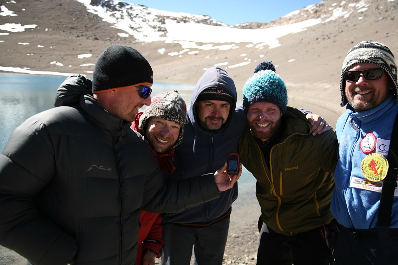
A crater lake situated in a half-open caldera of the lowest of the "Three Crosses". On March 12th, 2015 a group of Polish divers has made a sequence of dives in the lake. As of that date this is the highest lake anyone has ever made a scuba dive in. The depth of the lake is 12.1 meters, water teems with two species of mesoplankton. NASA radar measurements indicate an altitude of 5915 meters, however a handheld GPS showed an altitude of 5906 meters.
Detailed description is available on a Facebook page and the Expedition's Website.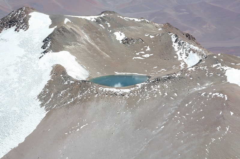

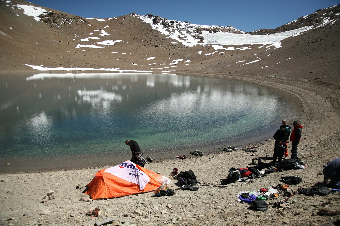

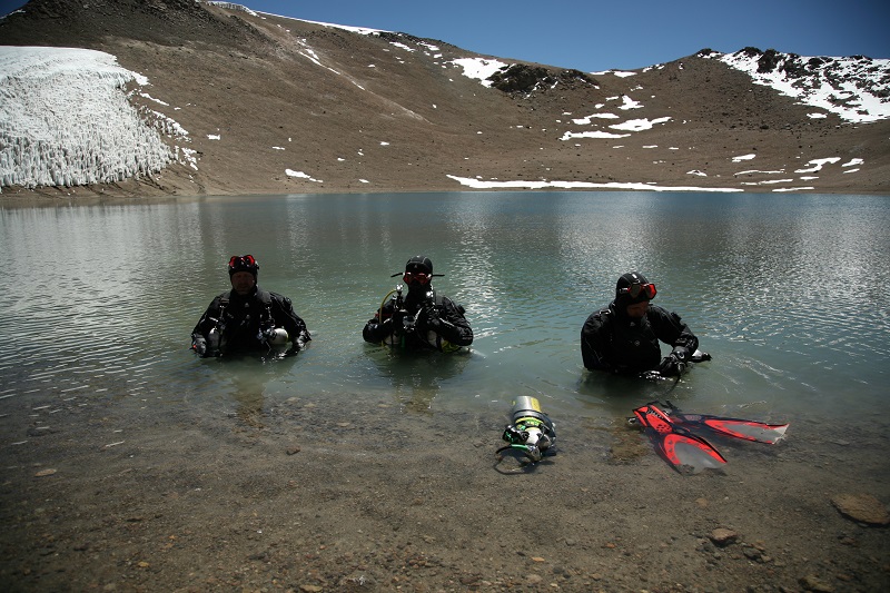


Lake Licancabur (a pool - by our measures) is one ot the most famous of high altitude lakes. One of the reasons is that this is the place where in 1981 the highest scuba dive took place - a record that was valid for 34 years (1981-2015). It has also been a target of several scientific expeditions that consider it a model for extraterrestial lakes. The mountain is blessed with a relatively easy access - it is situated about 35 km from San Pedro de Atacama. It is frequented by climbers, and we have plenty of pictures available - from different years and seasons.

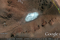
Aguas Calientes is a volcano in northern Chile. Its crater holds one of the most interesting lakes - due to its colour. It is a true gem; many lakes can be described as 'emarald' or 'sapphire' but only a handful - as a 'ruby'. NASA/SETI scientists think that "red water [is] indicating a dense population of microorganisms".
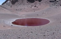
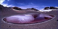
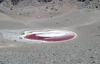

Cerro Bonete Chico is fourth highest peak of the Andes reaching 6759 meters of altitude. It remained unclimbed as late as 1970. Laguna Inca lies in the main crater of the massive at about 5100-5150 metres. It measures about 2.2x1.1 km and is likely one of the highest lakes of this size. However, still higher, at about 5850 metres of altitude lies a much smaller lake, which measures only about 150x100 meters. Judging from the sediments on the slopes of this little basin, the lake is occasionally nearly twice its current size.

A long list of geographic places located in the Ojos del Salado area named after Death (El Muerto) makes us wonder about the creativity of the name-givers, but also about hostility of the environment. The peak of El Muertito (5961 metres) is indeed a little brother of El Muerto (6488 metres) and is located about 5 km to the east of it. The volcano lies at the Chilean-Argentinian border and hosts a crater pool in a regularly shaped caldera. According to this report the volcano has not been climbed until 2011. So, we're lucky to have a beautiful picture of the laguna. It is again one of the rarest colourations - ruby red. Jonathan Kreiss-Tomkins, author of the trip report, writes:
![]()
There are two theories behind its otherworldly beet red color. The first is that the color comes from purely mineral processes, namely iron cycling. The second theory is that microbes mediate oxidation in the acidic pool. According to Cara Santelli, a research geologist at the Smithsonian Institution, "If there is microbial life, it would be a great analog to studying life on other planets."
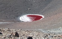

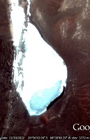
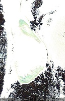
Continuing in the vein of naming peaks in relation to Death, Mulas Muertas (The Dead Mules) is a popular acclimatisation target for climbers relaxing in the thermal ponds at the shore of Laguna Verde. The peak at 5910 metres is usally not reached, as it is too long a walk to reach it starting from 4350 metres. Mountaineers usually save their strength for the real reason they come to the area - Ojos del Salado. We do not have climbers' photos, but we do have 6 Google Earth images taken between Feb 2006 and Sep 2013. I've chosen 4 shots with the best quality and presented them chronologically below. The lake is covered with ice on all of them. However, an examination of picture taken on 30th Nov 2012 (second from the left) shows that parts of the lake have thawed. Please notice, that the thawed part was refrozen as early as 27th Jan 2013, so it is likely, that ice thaws only for one or two months a year.


Ridonglabo is the first Himalayan lake on our list. It is clearly visible on Google Earth photos and it can be seen that the lake thaws even in late spring (Google image is dated May 18, 2014). A 1988 map has an elevation of 5801, but I have used Google Earth's altitude, for consistency with other measurements and becuse it is newer. Please note the enormous (1300x600m) Karda Lake to the southeast of Ridonglabo at elevation of approx. 5600 meters.


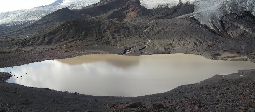
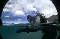
The lake has been discovered by a Polish Expedition in March 2012, while on a reconnaisance trip to explore for a possible traverse of Ojos del Salado. They were originally trying to dive in the Ojos del Salado pool, but ultimately dove in Lago de los Polacos. The banner picture at the top of the page shows the lake in good details. Small living creatures were discovered while diving, but it was no plancton. They were about 2 cm in length and it is likely they migh have been salamander larvae. The organisms looked similar to this.
Please follow the link to read a trip report to this high altitude lake.
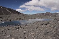


Karda Lake is enormous compared to all previous lakes and pools on the list. It has about 70 hectares in surface area, more than all the above combined. It is one of many lakes that appeared in the past decade or two near terminal moraines of Himalayan glaciers as a result of Global Warming. A good discussion regarding the topic can be found a the site of Japanese Space Agency. We have a Google Earth photo and a photo from an expedition climbing Mt. Everest from the east. The lake lies about 15kms from Mt. Everest.


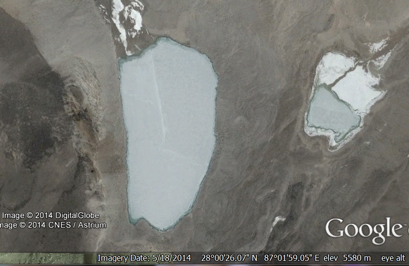
Just north of Kangshung Glacier there are two lakes located at 5520-5580 meters of altitude. The bigger is measuring 570x260 meters, while the smaller is about 270x190 meters. They are located 11 km to the East and 3 km to the North of Mount Everest. We have two Google Earth photos of good quality, as well as a picture from Everest ascent - shot at 8600 meters on the Kangshung face.


Thukpe Dzingbu (Lake of Compassion) is a pool frequented by pilgrims to Mount Kailash. The peak has never been climbed as it is a holy mountain for
Hindus, Buddhists as well as followers of the Jain and Bonpo (Tibetan) religions. Reinhold Messner was given the opportunity by the Chinese
government to climb it, but he declined. He said: "If we conquer this mountain, then we conquer something in people's souls..."
We have plenty of photos of the beautiful lake.

Baruntse Lake is situated near a group of lakes long known under a collective name of Panch Pokhari. "Pokhara" means "a pond" or "a pool" in Hindi and Nepali. Panch Pokhari (or Pokhri) simply means "Five Lakes". The lakes in question lie in the Makalu Barun part of Nepal Himalayas, just 15 kilometers south of Mount Everest. They are 5 northernmost lakes of the Hunku Valley but, as we can see in the Google Earth photo below, there are many more lakes in the area. Panch Pokhri highest (notheastern) lake lies at 5495 meters and it has been considered to be the highest of the group for many years. However, as a result of glacier melting, a new, higher lake in the eastern part of the valley has appeared around 2012. It has an elevation of 5555 meters, which conveniently suits the "five" motif of the area.
We have marked the newly forming lake on the Google Earth photo. The other pictures are presenting different Panch Pokhari lakes.
Indian Space Research Organisation puts it in no uncertain terms:
"Chholhamu Lake, also in North Sikkim district, at 5300 m elevation is the highest lake in India."
However, Google Earth indicates that Chholhamu Lake (also Cho Lhamu or Tso Lhamo) is only at elevation of 5100 meters. There are tens of lakes in the
nearby area, and some of them are reaching as high as 5500 meters of altitude. The four biggest lakes (Cho Lhamu, Gurudongmar and two Kanchengyao lakes)
are quite sizable. They all have about 2 kilometers of length and are 700-800 meters at their widest. There are many other bodies of water that easily
fit into our definition of a lake, measuring several hectares in surface area. Unfortunately, as the area borders Tibet, only Indian tourists are allowed
to visit it and they also need to obtain Restricted Area Permit from Sikkim Police and Indian Army.

Orba Co would be just one of many lakes in the western part of Tibet situated above 5000 meters, were it not for the three islands that rise from its waters. They are considered the highest islands in the world. We do not have good quality photos, Google Earth shots are as blurred as they can be. But we have an aerial photo that shows the islands in some detail. If you are an island lover, you can visit this site that lists most peculiar islands (in Spanish).


Laguna Glaciar is a beautiful glacier lake in the Illampu - Janq'u Uma (Ancohuma) massif in Bolivia. We have only a couple of photos made by the climbers, while the Google Earth shots are of barely acceptable quality.


Lake (Tal) Tilicho is a big Himalayan lake to the north of the Annapurna massif. It is almost 4 kilometers in length and about 1.1-1.4 km wide. It is also quite deep as for mountain lakes, reaching 85 meters. The lake can be visited as a side excursion for trekkers circling the Annapurna range. We have plenty of photos of the lake available.


Sabalan Lake is the highest body of water outside of the Andes and Himalaya/Tibet. It sits in the crater of the third hihgest mountain in Iran. The volcano is an important place for the followers of Zoroastrianism - the eldest of all monotheistic religions. It is said that Zarathustra used to meditate there.


Harris Tarn is the highest lake in Africa. It lies on the eastern slopes of Mt. Kenya.
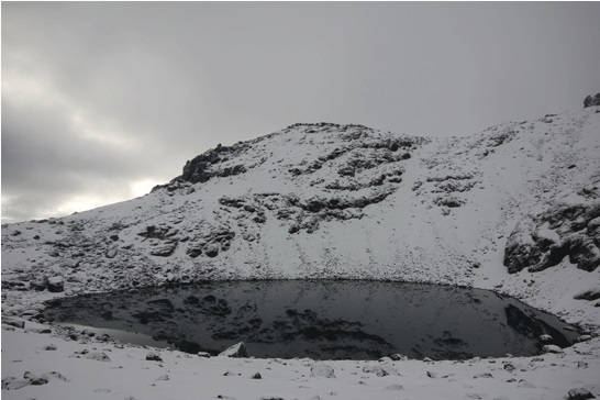


Simba Tarn is the second highest lake in Africa. It lies on the eastern slopes of Mt. Kenya, just couple of hundred meters norteast of Harris Tarn.


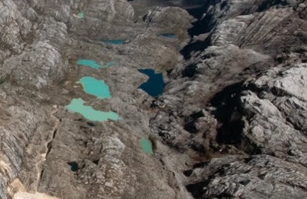
Emerald Lakes is a collective name of some 11 bodies of water near the base camp of Puncak Jaya (Carstensz Pyramid) - the highest peak of Indonesia, island of New Guinea and the Oceania.

Lago de la Luna is the highest lake in Northern America. It lies in the crater of Nevado de Toluca, the fourth highest volcano in Mexico.


Lago del Sol is the second highest lake in Northern America. It lies in the crater of Nevado de Toluca, just one big rocky mound away from Lago de la Luna.


Pacific Tarn is the highest lake in the United States and the third highest in North America. It lies about 9 klicks southwest of Breckenridge, Colorado.


Punta dei Corvi Pool is likely the highest body of water in Europe (ex aequo with Lake of Lovers in Russia). It lies on the southern slopes of Punta dei Corvi - a small peak in South Tirol, Italy. The peak is roughly halfway between Grawand and Fineilspitze (it: Punta di Finale).

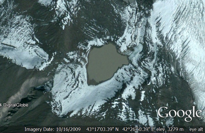
Lake of Lovers is likely the highest lake in Europe (ex aequo with Punta dei Corvi Pool in Italy). It lies on the southern slopes of Mt. Elbrus.
